MATTHEW REYNOLDS
Wired
Tuesday 29 November 2016

Google Timelapse – the interactive map that lets you explore how the planet has changed over the last 33 years – just got its biggest overhaul yet.
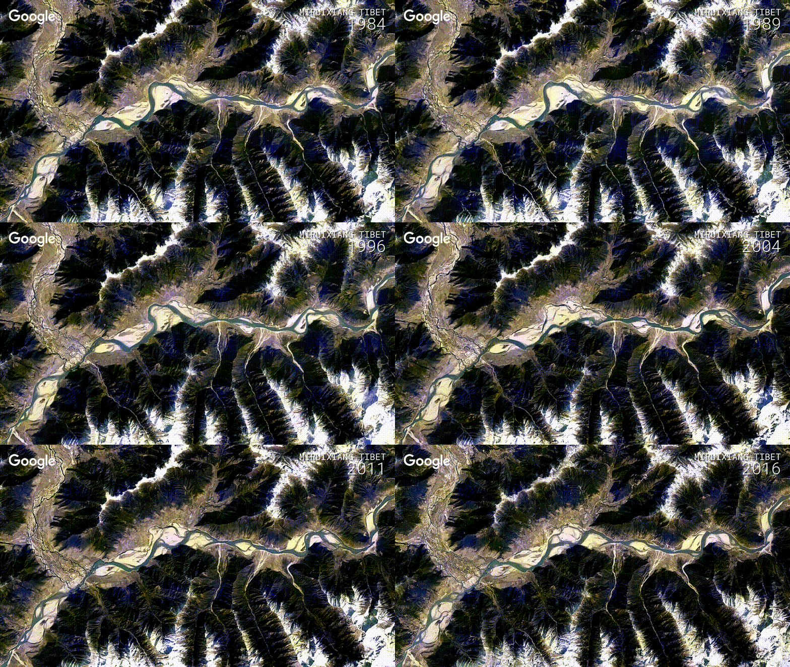
Timelapse was first released in 2013 and this update adds four more years of satellite imagery, petabytes of new data and sharper photos than in any previous version. Users can now explore Antartica’s shifting glaciers, Bangkok’s sprawling urban growth and the rapidly drying Aral Sea.

Using its Earth Engine, Google combined more than 5 million satellite images, that’s about 4 petabytes (4 million gigabytes) of data, to create 33 images of the entire globe. Fresh high-resolution images from the Landsat 8 and Sentinel-2 satellites were used to create sharper and more detailed timelapses than ever before. Nasa’s Landsat 8 and 9 satellites capture around 1,200 images of the Earth’s surface every day, making up about 1 terabyte of data.
Google then turned those 33 huge 3.95 terapixel images of the globe into 25,000,000 multi-resolution video files. Carnegie Mellon CREATE Lab’s Time Machine library was then used to make those videos clickable and zoomable to turn the still images into a timelapse version of Google Earth.
The best GIFs from the new Google Timelapse

The Aral Sea has been drying out since the 1960s due to Soviet irrigation programmes. By 2007 it had been reduced to just 10 per cent of its original volume.

Brasilia, Brazil's capital city, was founded in 1960. By 2011 its population had reached more than 2.5 million.

New Cairo, a city to the southeast of Cairo was founded in 2010 to relieve the huge population strain on the Eygptian capital.

Pine Island glacier is the fastest retreating glacier in the Antarctic. In 2015 a 225 square mile chunk of the glacier detached after a 20-year-old rift deep within the glacial ice finally made its way to the surface.

The population of Valencia, on the southeastern coast of Spain, exploded in the wake of Spain's transition to a democracy in the latter half of the 1970s.

This Tibetan lake may be getting bigger because of increased rainfall, or because glaciers in the nearby Himalayas are starting to melt.

The course of the Tambopata River in southeastern Peru is constantly changing over time as smaller streams become absorbed into the main body of water.

Solar Star, the 597 megawatt plant in Los Angeles, California was completed in 2015 and is the world's largest solar power plant.

The eastern span of the San Francisco-Oakland Bay Bridge was replaced between 2002 and 2013 after suffering damage in the 1989 Loma Prieta earthquake.

Originally built in 1914, the Panama Canal underwent a recent expansion between 2007 and 2016 that doubled the capacity of the artificial waterway.

Google Timelapse – the interactive map that lets you explore how the planet has changed over the last 33 years – just got its biggest overhaul yet.
Timelapse was first released in 2013 and this update adds four more years of satellite imagery, petabytes of new data and sharper photos than in any previous version. Users can now explore Antartica’s shifting glaciers, Bangkok’s sprawling urban growth and the rapidly drying Aral Sea.

Using its Earth Engine, Google combined more than 5 million satellite images, that’s about 4 petabytes (4 million gigabytes) of data, to create 33 images of the entire globe. Fresh high-resolution images from the Landsat 8 and Sentinel-2 satellites were used to create sharper and more detailed timelapses than ever before. Nasa’s Landsat 8 and 9 satellites capture around 1,200 images of the Earth’s surface every day, making up about 1 terabyte of data.
Google then turned those 33 huge 3.95 terapixel images of the globe into 25,000,000 multi-resolution video files. Carnegie Mellon CREATE Lab’s Time Machine library was then used to make those videos clickable and zoomable to turn the still images into a timelapse version of Google Earth.
The best GIFs from the new Google Timelapse

The Aral Sea has been drying out since the 1960s due to Soviet irrigation programmes. By 2007 it had been reduced to just 10 per cent of its original volume.

Brasilia, Brazil's capital city, was founded in 1960. By 2011 its population had reached more than 2.5 million.

New Cairo, a city to the southeast of Cairo was founded in 2010 to relieve the huge population strain on the Eygptian capital.

Pine Island glacier is the fastest retreating glacier in the Antarctic. In 2015 a 225 square mile chunk of the glacier detached after a 20-year-old rift deep within the glacial ice finally made its way to the surface.

The population of Valencia, on the southeastern coast of Spain, exploded in the wake of Spain's transition to a democracy in the latter half of the 1970s.

This Tibetan lake may be getting bigger because of increased rainfall, or because glaciers in the nearby Himalayas are starting to melt.

The course of the Tambopata River in southeastern Peru is constantly changing over time as smaller streams become absorbed into the main body of water.

Solar Star, the 597 megawatt plant in Los Angeles, California was completed in 2015 and is the world's largest solar power plant.

The eastern span of the San Francisco-Oakland Bay Bridge was replaced between 2002 and 2013 after suffering damage in the 1989 Loma Prieta earthquake.

Originally built in 1914, the Panama Canal underwent a recent expansion between 2007 and 2016 that doubled the capacity of the artificial waterway.
No comments:
Post a Comment