Scientific American
April 10, 2016
I'm still going through the USGS image database for Mount St. Helens. It's going to take me a while - there are almost two thousand images to sort, catalog, and save.
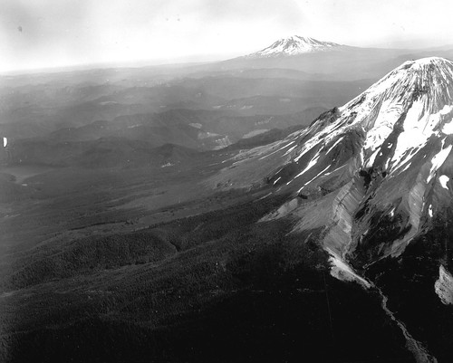
Really magnificent pre-eruption photo of Mount St. Helens. Definitely enlarge this. You'll see some fabulous glacial geology, inverted topography, old lava domes, and Mount Adams. Drooling now.
PRE-ERUPTION AERIAL VIEW NORTHEASTWARD OF MOUNT ST. HELENS IN THE FOREGROUND, MOUNT RAINER IN BACKGROUND. IMAGE AND CAPTION COURTESY USGS.
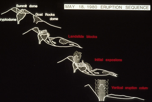
Here's a nice visual explanation of the May 18th eruption.
Here's a nice visual explanation of the May 18th eruption.
SIMPLE DIAGRAM BY J.G. MOORE SHOWING MOUNT ST. HELENS ERUPTION SEQUENCE OF MAY 18, 1980. SKAMANIA, COUNTY, WASHINGTON. IMAGE AND CAPTION COURTESY USGS.
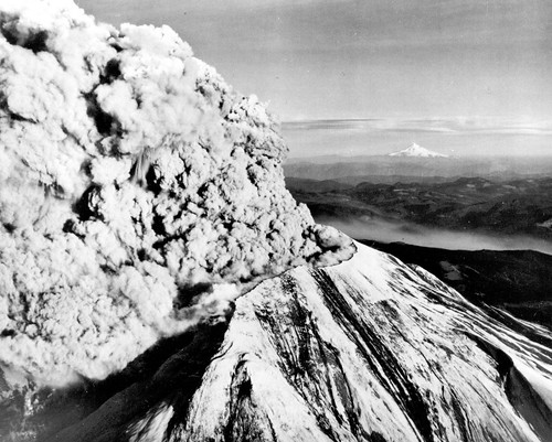
For my Oregon peeps: Mount St. Helens in eruption, with Mount Hood in the background.
For my Oregon peeps: Mount St. Helens in eruption, with Mount Hood in the background.
MOUNT ST. HELENS IN ERUPTION, LOOKING TOWARD THE SOUTHEAST ON MAY 18, 1980, WITH SNOW-COVERED MOUNT HOOD ON THE DISTANT HORIZON. SKAMANIA COUNTY, WASHINGTON.
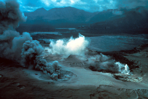
Eerie photo taken right after the May 18th eruption. We're looking across Spirit Lake. In the foreground, steam bursts from fumaroles in the blast deposits.
Eerie photo taken right after the May 18th eruption. We're looking across Spirit Lake. In the foreground, steam bursts from fumaroles in the blast deposits.
OBLIQUE AERIAL VIEW ACROSS SPIRIT LAKE AFTER THE ERUPTION OF MOUNT ST. HELENS; SECONDARY STEAM FUMAROLES IN BLAST AREA IN FOREGROUND. SKAMANIA COUNTY, WASHINGTON. 1980. IMAGE AND CAPTION COURTESY USGS.
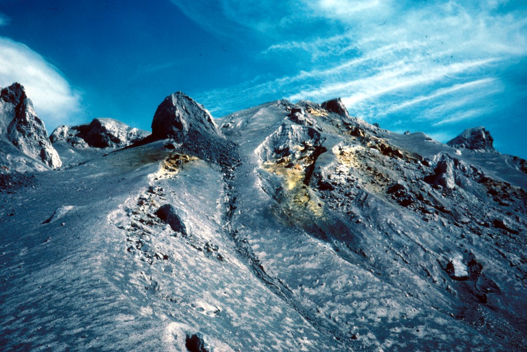
Absolutely gorgeous image of fumaroles on a pyroclastic flow from May 18 1980.
Absolutely gorgeous image of fumaroles on a pyroclastic flow from May 18 1980.
FUMAROLES ON PYROCLASTIC FLOW OF MAY 18 ERUPTION OF MOUNT ST. HELENS. SKAMANIA COUNTY, WASHINGTON. JUNE 1, 1980.
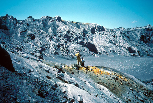
This is a rather gorgeous fumarole on a pyroclastic deposit from the May 18 eruption, with geologists for scale. You know, catastrophic destruction makes for magnificent landscapes.
This is a rather gorgeous fumarole on a pyroclastic deposit from the May 18 eruption, with geologists for scale. You know, catastrophic destruction makes for magnificent landscapes.
FUMAROLES AND GEOLOGISTS ON PYROCLASTIC FLOW OF MAY 18 ERUPTION OF MOUNT ST. HELENS. SKAMANIA COUNTY, WASHINGTON. JULY 1, 1980. IMAGE AND CAPTION COURTESY USGS.
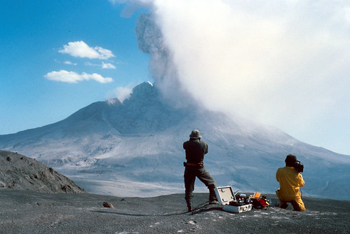
Geologists watching the August 7th, 1980 eruption. Dunno about you, but I'd have to spend a lot of time and effort screwing my courage to the sticking-place before I'd be able to stand there filming the volcano going boom after what it did in May.
Geologists watching the August 7th, 1980 eruption. Dunno about you, but I'd have to spend a lot of time and effort screwing my courage to the sticking-place before I'd be able to stand there filming the volcano going boom after what it did in May.

TIME LAPSE OF AUGUST 7, 1980, ERUPTION OF MOUNT ST. HELENS. GEOLOGIST IN FOREGROUND FOR SCALE. SKAMANIA COUNTY, WASHINGTON. IMAGE AND CAPTION COURTESY USGS.
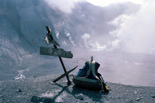
Eruptions are quite rough on volcano monitoring equipment. This is Kid Valley geodetic target after the eruption above got through with it.
Eruptions are quite rough on volcano monitoring equipment. This is Kid Valley geodetic target after the eruption above got through with it.
KID VALLEY GEODETIC TARGET AFTER AUGUST 7 ERUPTION OF MOUNT ST. HELENS. SKAMANIA COUNTY, WASHINGTON. AUGUST 9, 1980. IMAGE AND CAPTION COURTESY USGS.
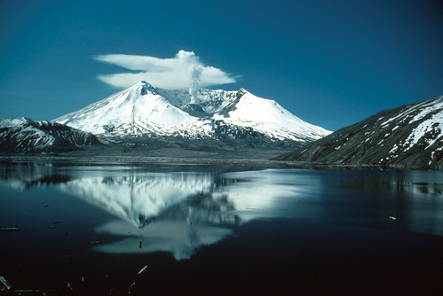
Here's a really lovely image from May 19th, 1982. You can see that Mount St. Helens hasn't quite gone back to sleep yet. Photo is by Lyn Topinka, who has taken many marvelous pictures of that volcano. You'll see more of her work as we go along.
Here's a really lovely image from May 19th, 1982. You can see that Mount St. Helens hasn't quite gone back to sleep yet. Photo is by Lyn Topinka, who has taken many marvelous pictures of that volcano. You'll see more of her work as we go along.
MOUNT ST. HELENS REFLECTED IN SPIRIT LAKE, TWO YEARS AFTER THE ERUPTION OF MAY 18, 1980. SKAMANIA COUNTY, WASHINGTON. MAY 19, 1982. PHOTOGRAPH BY LYN TOPINKA. IMAGE AND CAPTION COURTESY USGS.
I'll have more lovely photos from before, during, and after May 18th, 1980. I've also got some non-volcanic adventures planned for this month. We're going to be venturing into geology quite different from the young stuff around Western Washington. Stay tuned!
I'll have more lovely photos from before, during, and after May 18th, 1980. I've also got some non-volcanic adventures planned for this month. We're going to be venturing into geology quite different from the young stuff around Western Washington. Stay tuned!
No comments:
Post a Comment