
The extensive flooding that took place in Toronto this week is linked to extensive development that has re-routed and buried numerous small streams that used to drain the area. When heavy rainfall overwhelms the ability of storm drains to handle the volume, excess water tries to follow some of the lost channels
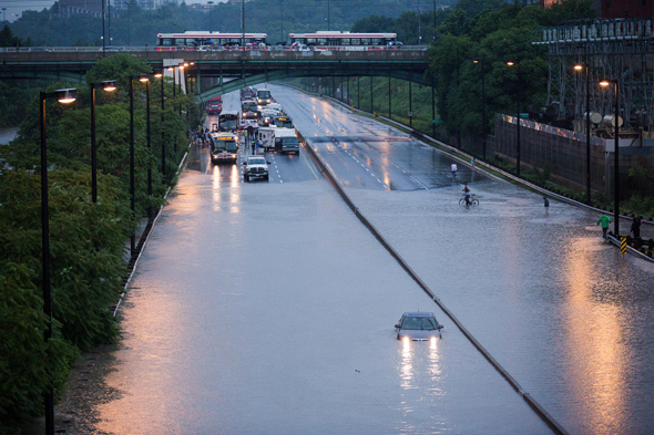
Photo Credit: BlogTO.com - Tom Ryaboi

Photo: The Don Valley Parkway in Toronto Monday night, as seen from the Dundas Street bridge (Credit: Toronto Star)
The Toronto Star has published a great article on Toronto's "lost rivers":
Lost Rivers Reappear When Nature Takes Charge
The article references a great little site called Lost River Walks. Of particular interest is the map that shows the location of most of the streams that once flowed beneath central Toronto. The map on the website is linked so you can click on particular streams to get more detailed information.
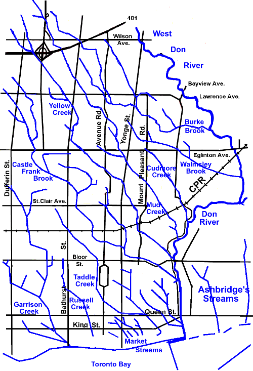
(Map Reference: http://www.lostrivers.ca/centralkey.htm)
No comments:
Post a Comment