
They Don't Make Maps Like this Anymore
Author: Riley Arthur, Photo Fellow, The Huffington Post
Posted: 12/01/2015 10:49 AM EST
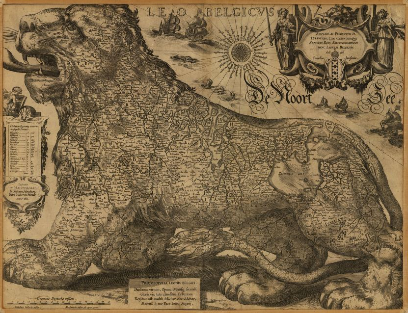
LEO BELGICUS, HONDIUS, JODOCUS, 1563-1612.
Since the human invention of territorial borders there has been a
fascination with maps. Maps have defined the way we understand th.e
world, outlining the geographical -- and often political -- delineations
of humanity.
"Worlds
Revealed," a new Library of Congress blog created in November, will feature some of the more
vintage maps from the LoC archive. The
maps, dating back as early as the 1500s, show a time when cartographers used
their own artistic stroke to illustrate the world, including
cities, railroads, national parks -- even the cosmos.
"With this blog, we invite you to broaden your conception of
what a map is," the Library of Congress notes on its site. "We will
highlight cartographic objects from our collections that sometimes go beyond
what usually ends up in exhibits and in textbooks and bring to the forefront
uncataloged objects that have never before been placed online."
Take a
peek into the maps of "Worlds Revealed" below.
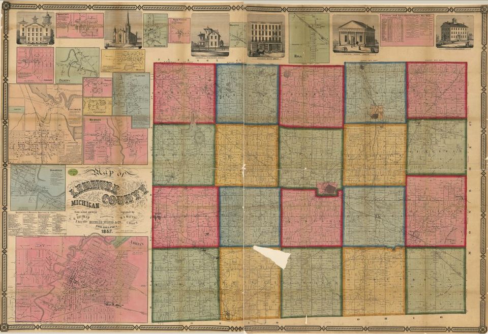
Map of Lenawee County, Michigan, 1857
·
BECHLER
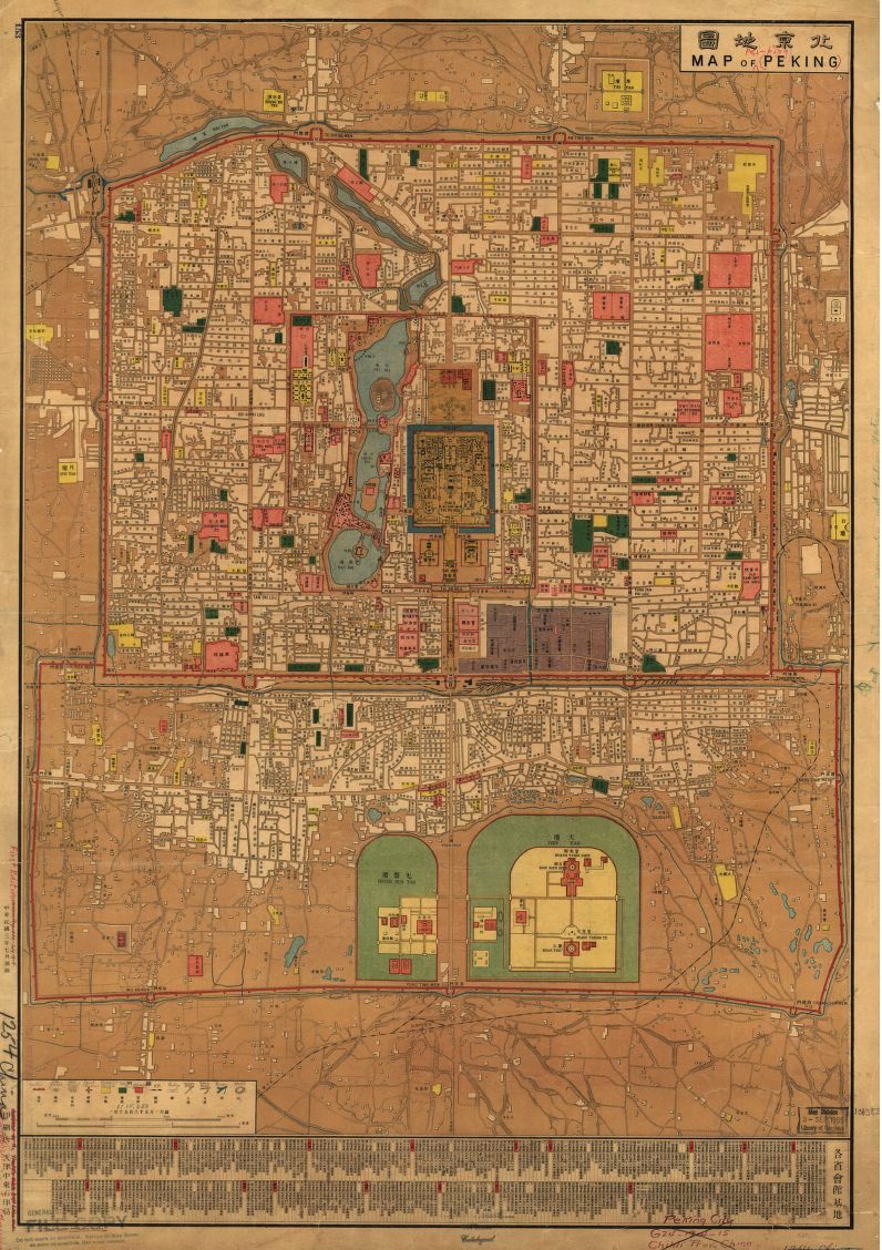
Map of Peking, 1914.
·
TIANJIN/ LIBRARY OF CONGRESS
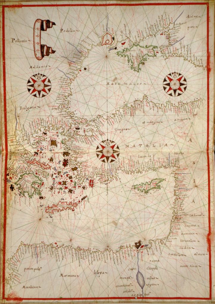
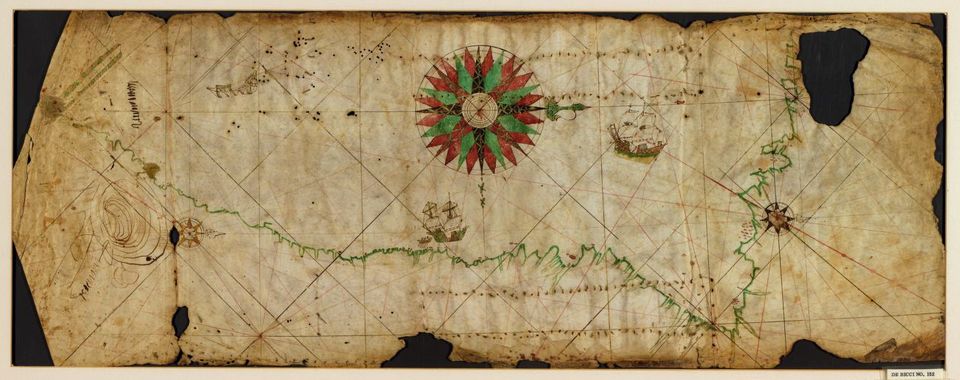
A portolan chart of the Atlantic Ocean and adjacent continents, 1633.

·
PASCOAL ROIZ/LIBRARY OF CONGRESS
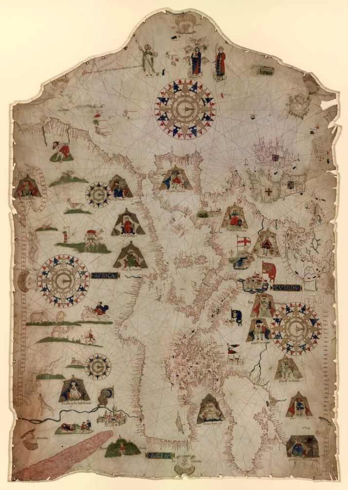
Portolan atlas of the Mediterranean Sea, 1590.
·
SEBASTIAN MüNSTER/LIBRARY OF CONGRESS
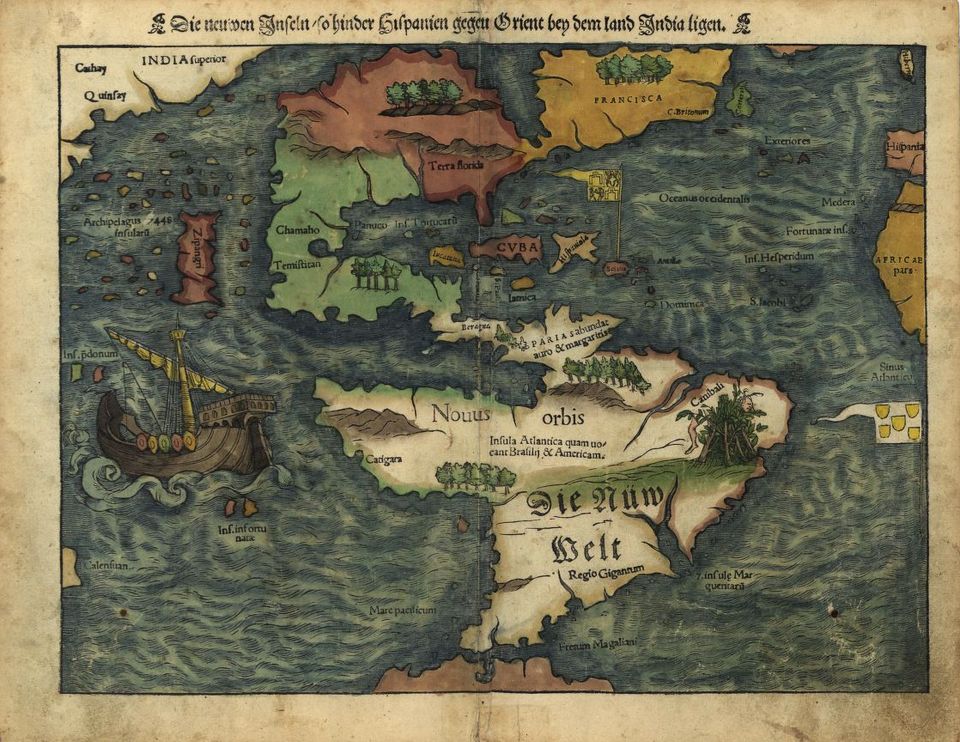
New weldt oder Inseln, so hinder Hispanien gegen Orient bey dem
land India ligen, 1550.
·
ARTHUR WILLIAM HUMMEL/LIBRARY OF CONGRESS
The great Qing Dynasty's complete map of all under
heaven, 1890.
·
LIBRARY OF CONGRESS
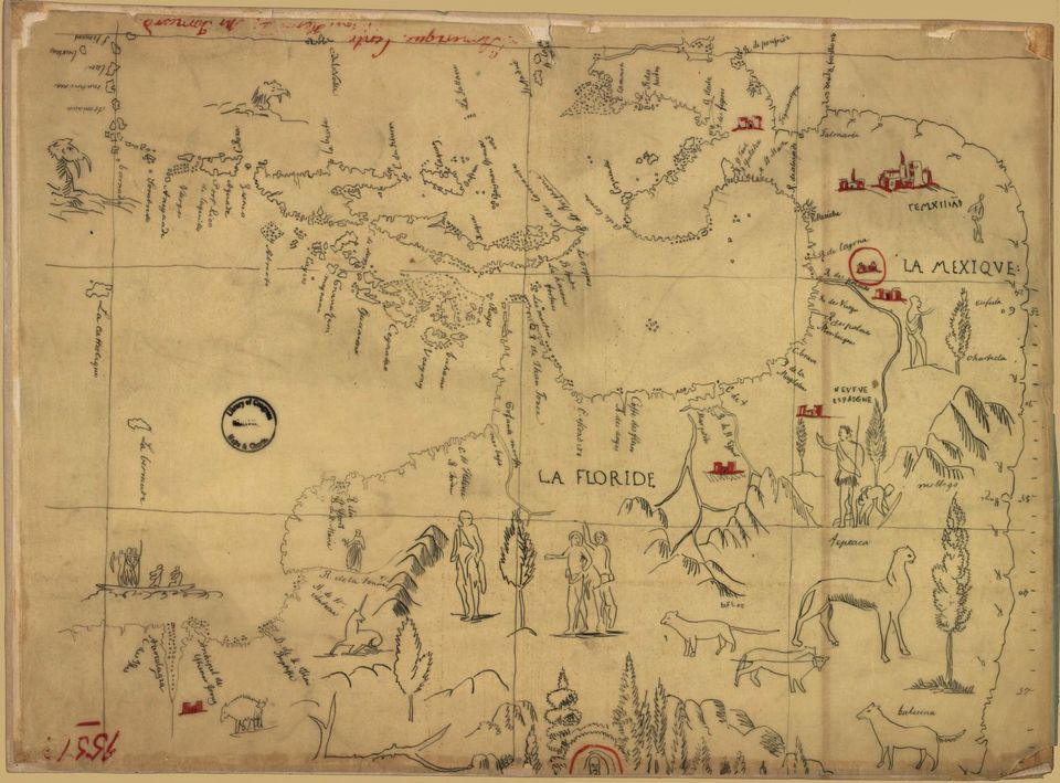
Central America, 1850.
·
ECKEBRECHT, PHILIPP ECKEBRECHT, JOHANNES
KEPLER, JOHANN PHILIPP WALCH/LIBRARY OF CONGRESS
The delineation of the south of the world , adapted to a singular
manner, 1630.

·
WILLIAM HOLE, JOHN SMITH/LIBRARY OF CONGRESS
Virginia, 1624.

·
W GODSON/LIBRARY OF CONGRESS
A new and correct map of the world : laid down according to the
newest observations, 1702.
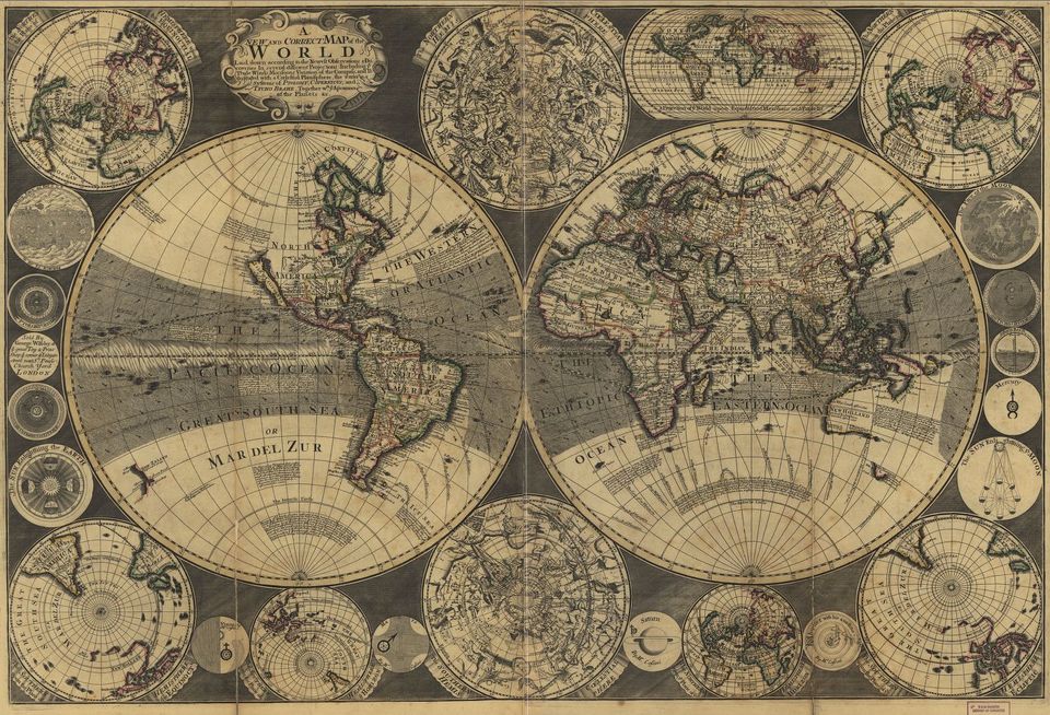
·
MATEUS PRUNES/LIBRARY OF CONGRESS
Chart of the Mediterranean, Black Sea, and the coasts of western
Europe and northwest Africa, 1559.
·
JODOCUS, HONDIUS, HUGUES PICART, JEAN
BOISSEAU/LIBRARY OF CONGRESS
Africa Board, 1640.

·
LIBRARY OF CONGRESS
Portolan chart of the Pacific coast from Mexico to northern Chile,
1500.
·
YUANYI MAO/LIBRARY OF CONGRESS
Wu bei zhi, 1644.

·
LEO BELGICUS, HONDIUS, JODOCUS, 1563-1612.
No comments:
Post a Comment